The Sandy Creek Trail has been on my to-do list all year. Located about halfway between Franklin and Clarion, the Sandy Creek Trail follows the path of the old Jamestown, Franklin, & Clearfield Railroad. The trail winds its way between the villages of Van and East Sandy, then continues west along the Allegheny River before terminating near PA-8.
This past weekend I finally made the four-hour trek to check it out. I wanted to make sure I’d have plenty of time to leisurely ride the trail, so given the round-trip eight-hour drive I decided to grab a hotel room in Clarion and make an overnight trip out of it. As soon as my day job ended on Friday, I loaded up the Forester, threw my inflater on the charger, and hit the road.
The drive took me up 322, a route I’ve driven too many times to count. But this time I kept going past State College and picked up I-80 for the rest of the drive. And as I started burning up miles of highway that I haven’t driven in decades, I realized just how easy it is to overlook our state’s beauty when it’s part of your daily commute.
Maybe that’s why I enjoy rail trails so much.

Anyway, Clarion was a great place to crash. I didn’t get to see much of the town but the hotel was within 20-30 minutes of multiple trailheads. I’m going to have to make a long weekend out of this place someday.
Even though I have a relatively inexpensive bike and a locking bike rack, I’m not comfortable leaving my bike out overnight. I see people doing this all time time with more expensive bikes, so maybe I’m just being paranoid — but it still seems like a bad idea. So I wheeled my bike up to the room and called it a night.
A recurring question on the various rails-to-trails groups I belong to is whether hotels care if you bring your bike into the room. I’ve never had a hotel so much as bat an eye. As long as you aren’t dragging a mud-caked bike and tracking dirt everywhere, you should be fine. If you do make a mess in a common area, be a decent person and just ask to borrow a broom.
The next morning I grabbed a hearty breakfast and made the 20-mile jaunt up to the Van trailhead. Getting there is pretty straightforward but the final 1/10th mile goes through an unmaintained access road that gets a little rough. I’d suggest using the East Sandy trailhead if you’re in a sedan or low-sitting vehicle, but the Prius I parked next to says you’re probably okay in just about anything.

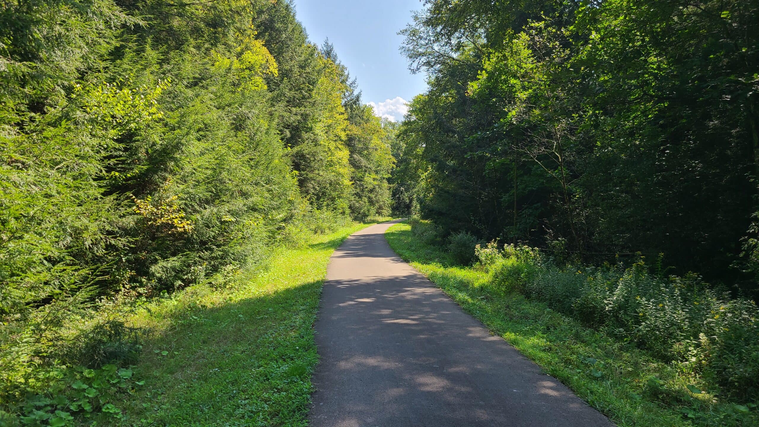
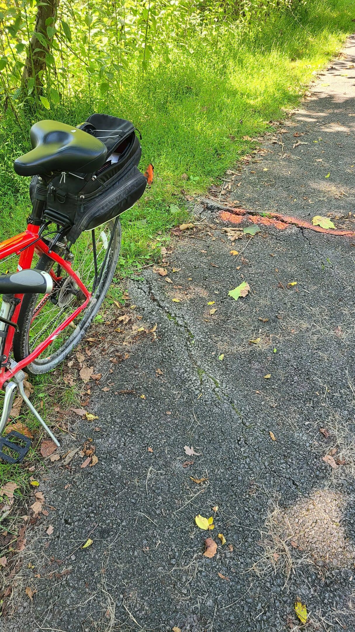
Weather for the day couldn’t have been any more perfect! Even as the cool morning air gave way to the mid-day sun, I spent most of the trail riding through shaded valleys. The trail surface is entirely paved except for the wood decking over the bridges. It’s all in very good condition except for a handful of organic speed bumps — more on those later.
I started my day by riding west. I followed East Sandy Creek as it twisted and turned through the lush forest on its way to join the Allegheny River. I spent the first half of the ride just taking in the scenery without worrying about metrics or framing that perfect shot, and I’m glad I did! The landscape defies description:

During the railroad’s construction in 1905, seven bridges were built to carry the line over East Sandy Creek as both made their way to the Allegheny River. After the line was abandoned in the 1980s, the land sat unused until being converted to a rail trail in 2002 – 2005. The bridges were all redecked and made safe for pedestrian use, and offer views that are impossible to ride past without stopping.

I’m not kidding: every single crossing offers amazing views. I could fill an entire post with this:


About two miles east of the Allegheny River sits Mays Mill Tunnel. The tunnel was originally bored as construction of the railroad commenced around 1905 – 1911. Workers were paid $1.50 per day to dig the tunnel almost entirely by hand. That’s roughly equivalent to $42 in 2021 — and that’s per day, not per hour. When the railroad abandoned the line in the 1980s, the tunnel began to decay rapidly. By the time the trail was completed in 2000, the tunnel had decayed so badly that restoration was not economically feasible. The trail planners did the next best thing:
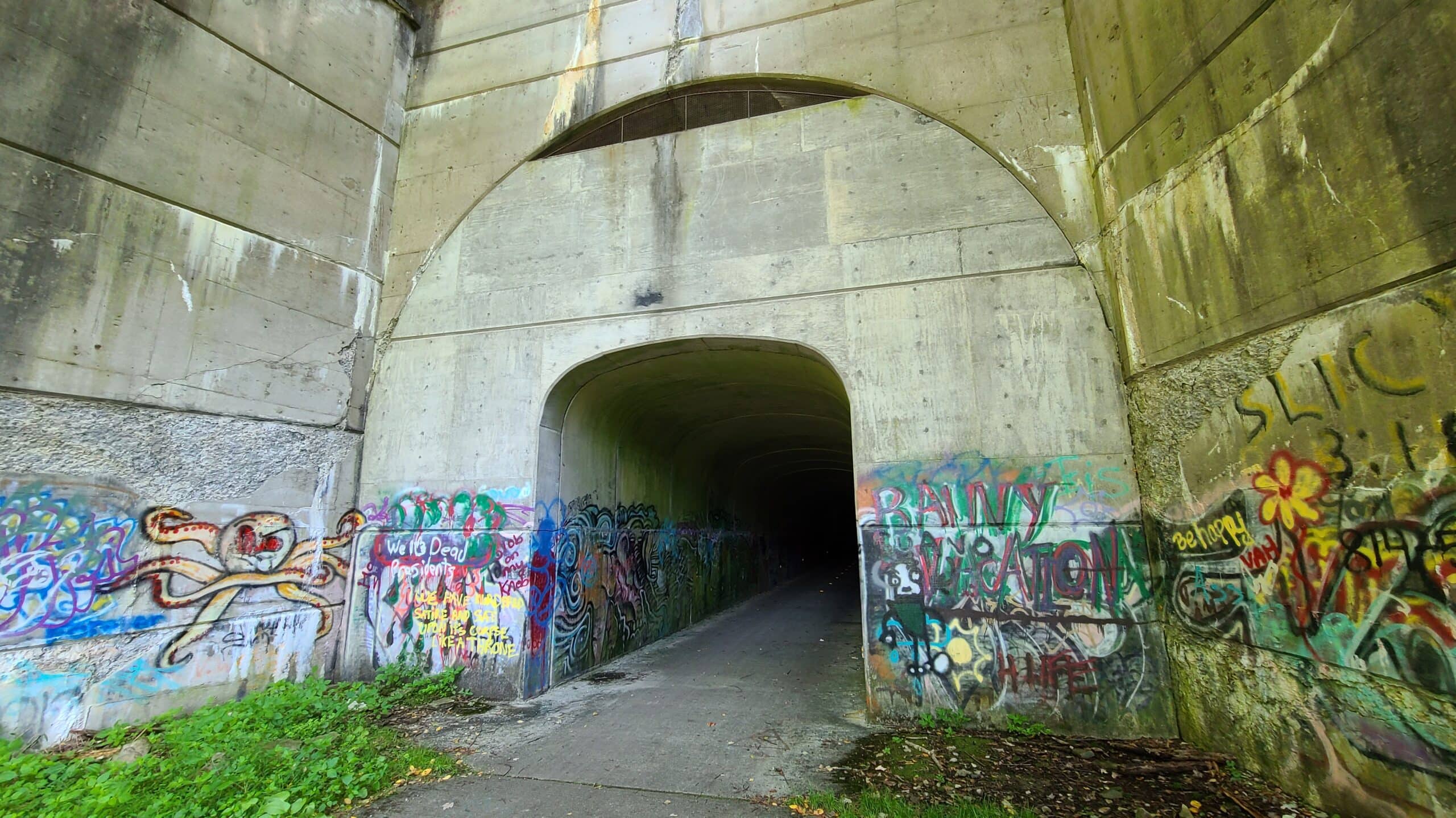
They built a second tunnel inside the first tunnel, and filled the void with old tires. As it stands today, the tunnel is clean and safe. It’s just shy of 1000 feet long and completely unlit, so make sure your bike has a decent headlight.
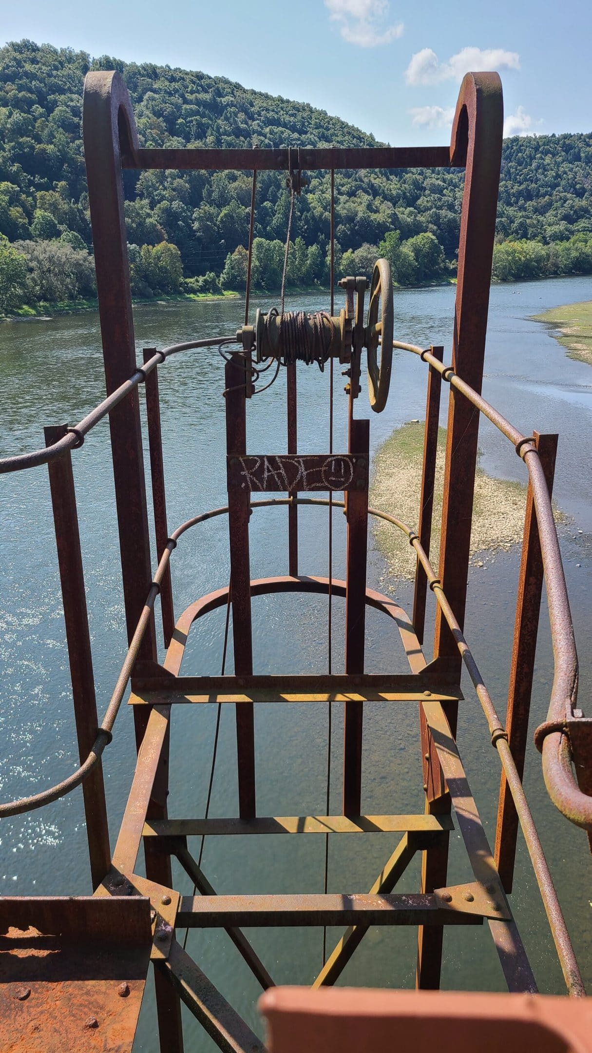
A few miles to the west you’ll encounter the 1300-foot Belmar Bridge:

The Belmar Bridge was originally built for the railroad in 1907. When it was redecked in the early 2000s, many of its original industrial features were left in place. The result is rusty stairs to nowhere and winches whose original purpose is long forgotten. My best guess is that they were used for maintenance during the bridge’s service life.
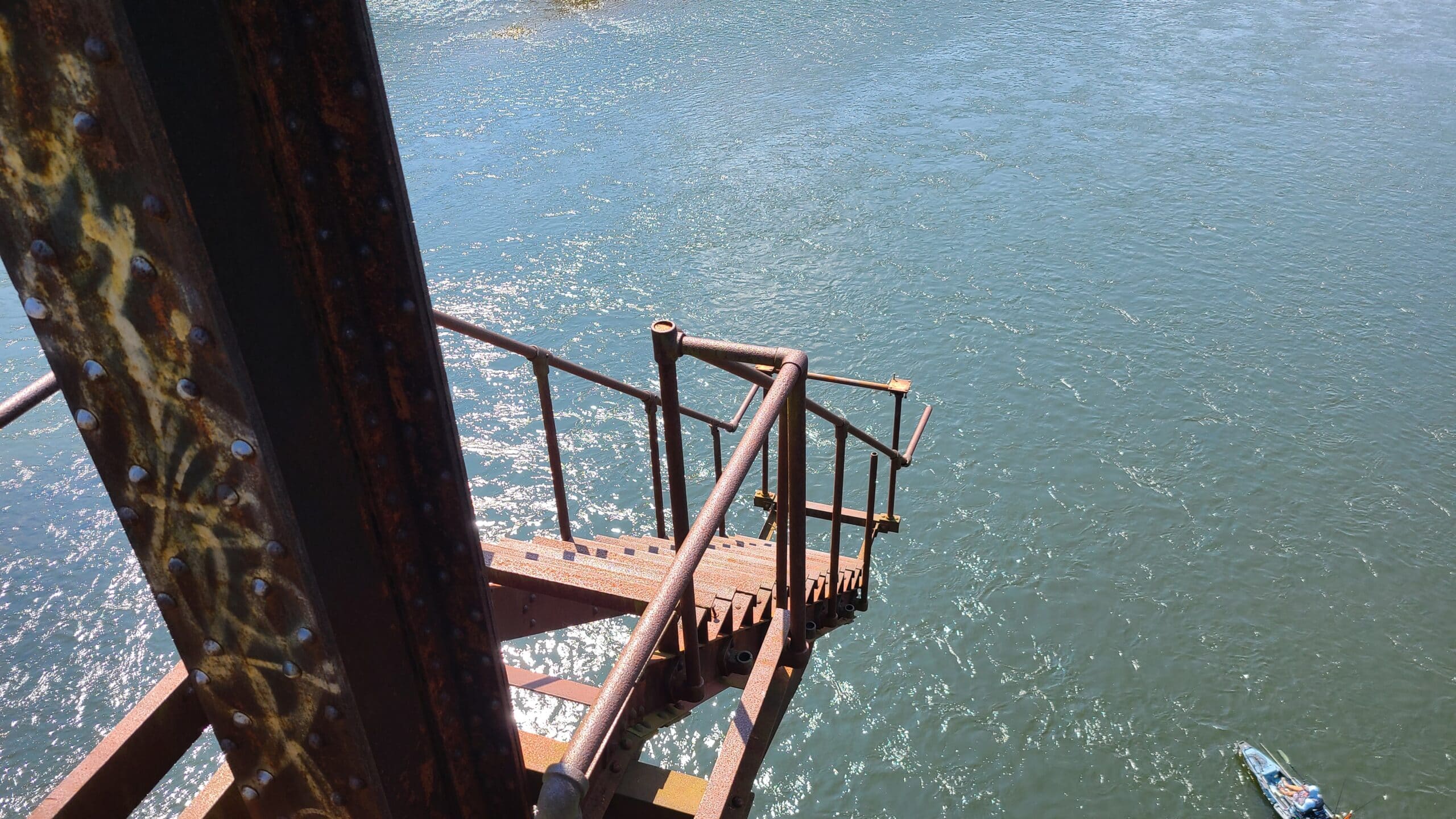

If you look down after crossing the bridge heading east, you’ll see another rail trail beneath you. The Sandy Creek Trail actually crosses over the Allegheny River Trail as it winds from Franklin to Emlenton. Immediately after the bridge there’s a connection between the two. Be prepared to walk your bike if you switch trails.
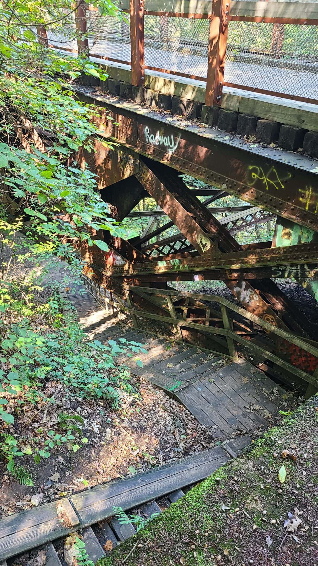

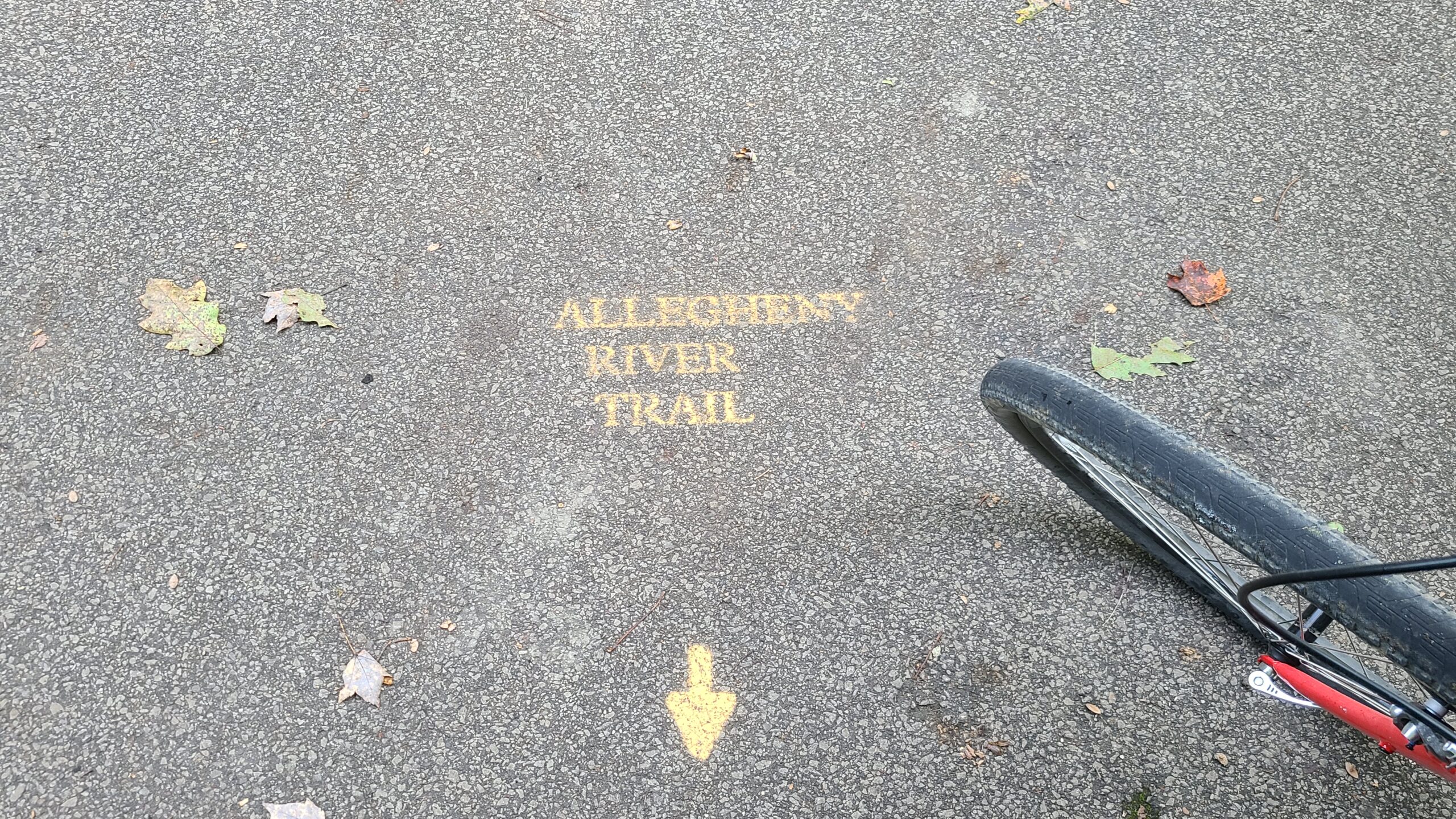
If you want to get a good taste of what the trail has to offer but don’t feel up to riding the full 24 miles, this bridge marks a great starting point! The Belmar trailhead is barely a tenth of a mile northwest of this bridge. Ride east about two miles and you’re at the Mays Mill Tunnel. By the time you exit the eastern portal of the tunnel, you will have seen five of the seven bridges with only a five-mile round trip.

If you want to take a medium-size trip, it’s only about eight miles from the Belmar Bridge to the Van trailhead. You’ll have a very slight uphill grade on the way out, but an equally gentle downhill grade on the way back. It’s not just the bridges; the entire trail offers amazing scenery and photo ops. I absolutely recommend riding at least the full length east of here. If you’re a novice rider and unsure of your speed, this will take roughly two hours round trip at a very leisurely pace.
The best trail experience is east of the Belmar bridge. The four miles to the west are still worth a ride, but the view changes significantly from a lush forest paradise to … just a relaxing remote ride. Don’t get me wrong — the view to the west isn’t bad at all. It’s just hard to compare to what lies east. If the eastern 2/3rds of the trail are like winning a billion-dollar lottery, then the third to the west is like winning a ten-million-dollar lottery. Still great … just not as great.

Remember way back in the beginning of this post, when I told you that the trail quality was excellent except for a few organic speed bumps? Ride west, and you’ll see exactly what I mean.
As I was heading west near the western terminus, I was startled by the sudden appearance of a caboose in the woods. I caught it out of the corner of my eye and instead of just stopping and looking back like a sane person, I physically turned around without stopping. That’s when I nailed this thing at full speed. The jolt was hard enough to pop my iPhone out of its holder. No damage — hooray for Unicorn Beetle cases!


I can’t find any information about the caboose online. At all. I’m not sure if it’s from the original railroad or just something someone hauled here, but it looks like someone at one point tried to make a cabin out of it.
UPDATE: A helpful Facebook comment pointed out that this is the Penn Central Caboose #19257. It was built in 1927 and originally used on the Pennsylvania Railroad. The caboose may be private property and not part of the trail, so please stay out. I can find no further information on this particular car. If you happen to have any insight into its history, leave a comment below!
After crossing one more bridge, the trail unceremoniously ends at Fishermans Cove Road. From looking at the state LIDAR imagery, this road appears to follow the original railway bed west to Old Route 8. Hopefully the rail trail will extend out that way at some point in the future!

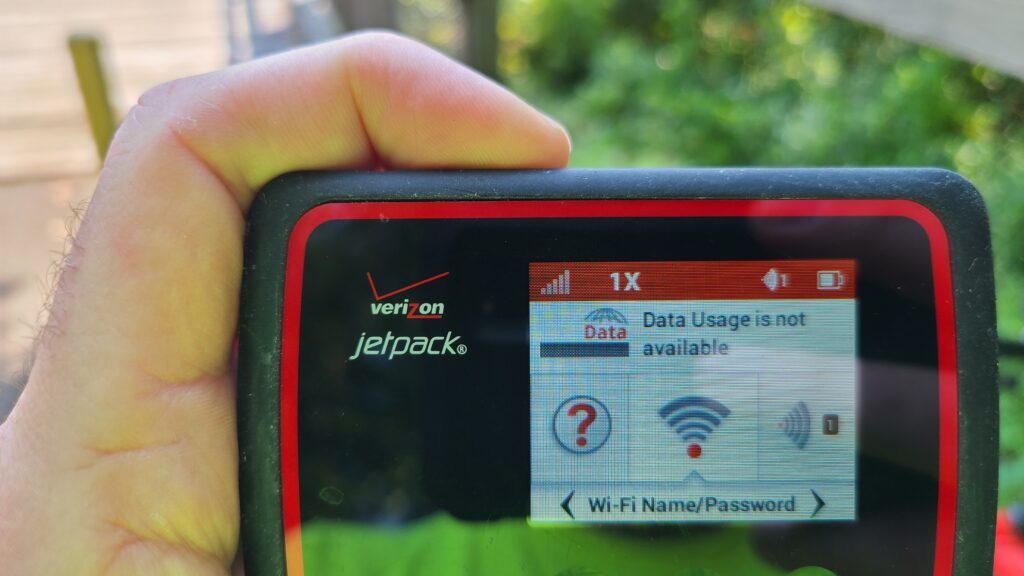
One last thing I need to point out. If you don’t do a lot of trail riding, it can be easy to forget that there are still large chunks of the state that don’t have cell service. It doesn’t matter what carrier you have; both my T-Mobile and Verizon devices lost signal for a good part of this trail. Make sure that you’ve got plenty of water and a basic repair kit. The trail is still fairly short so at worst, you’re only a few miles away from civilization. But an 8-mile walk pushing a shredded tire isn’t going to be much fun.