Western Pennsylvania is doing amazing work when it comes to rail trails. Rather than turning their back on history, they’re celebrating their industrial heritage by turning countless miles of disused rail lines into hundreds of miles of easily accessible, well-maintained rail trails. I’d go so far as to say it’s the greatest network of rail trails in the US — and they’re just getting started.
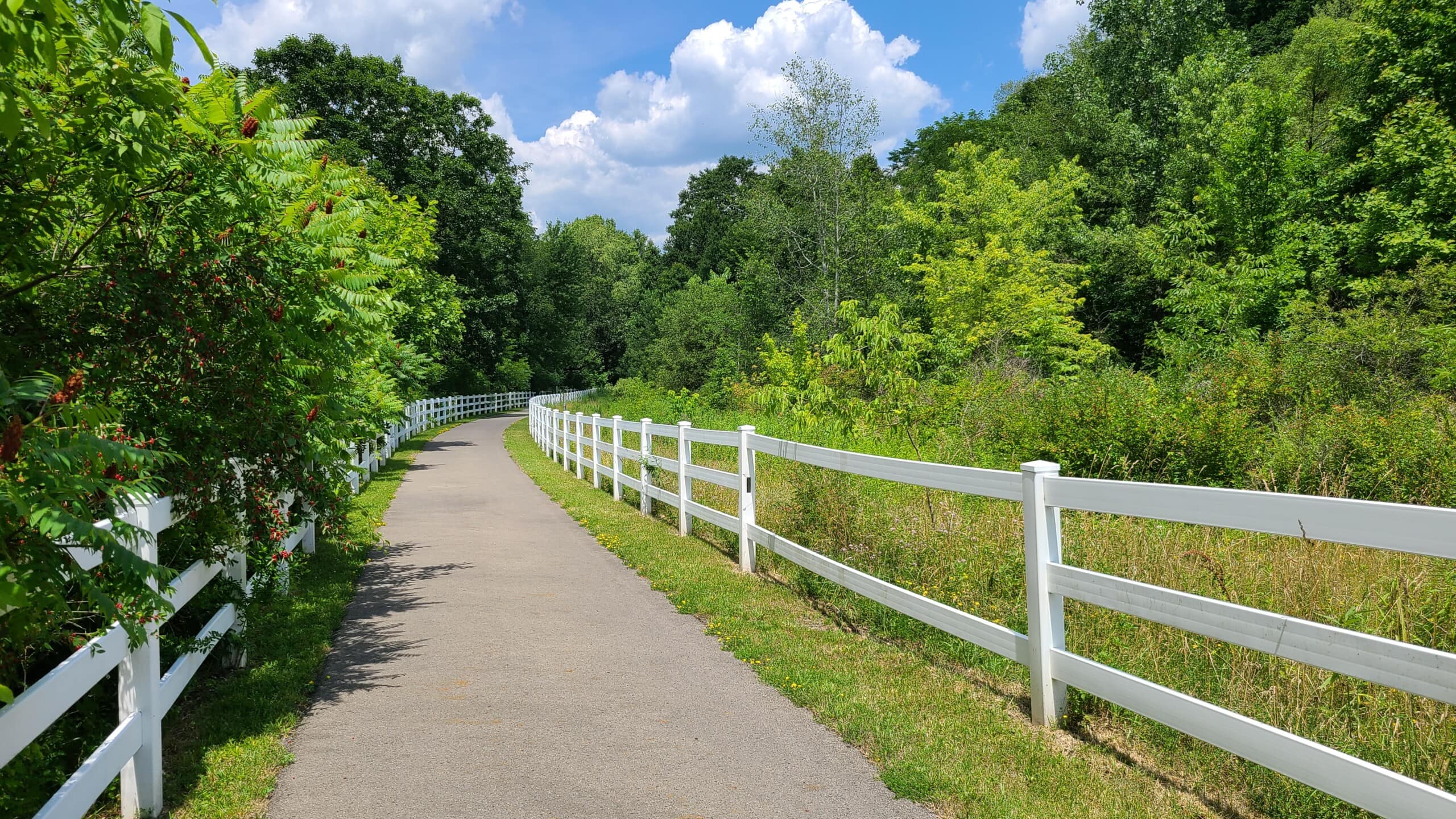
That’s why the Allegheny River Trail was next on my to-ride list. This trail follows the path of the circa-1850s Allegheny Valley Railroad (which is completely unrelated to the modern-day Allegheny Valley Railroad) as it meanders along next to the Allegheny River. The 30-mile stretch between Franklin and Emlenton is almost entirely paved, almost entirely flat (the elevation difference between the two trailheads is roughly 150 feet), and roughly half shaded, making this an excellent trail to push your endurance a little.

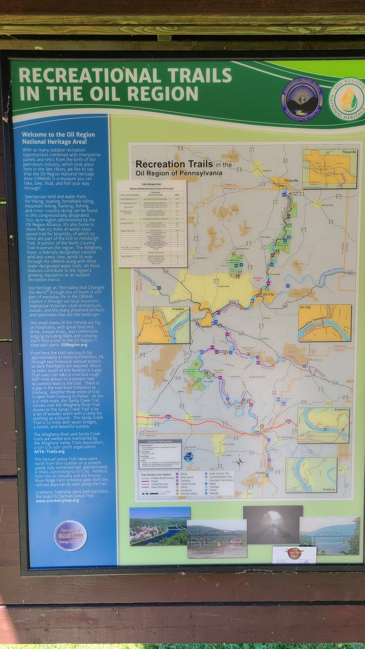

I started my ride at the northern trailhead, located just across the river from Franklin. The trailhead is easy to find and has an ample parking area. Even on a busy holiday weekend, we had no trouble finding a prime parking spot. A saltbox houses information on the Allegheny Valley Trails Association, and nearby pavilions house a bike repair station and picnic tables.
Note that the Samuel Justus Recreation Trail runs north a few miles from here, connecting the Allegheny River Trail to the not-yet-finished Erie to Pittsburgh Trail. There’s nothing wrong with the Justus trail, but if you want to ride the Allegheny River Trail, make sure you head south (river on your right, 322 on your left).

The trail is almost entirely paved, except for a short section just north of the Kennerdell Tunnel, southwest of Coal City. That stretch shares the ground with North Kent road for about a mile. Expect packed dirt, gravel, and the occasional jutting rock. This section probably makes this trail a bit much for a road bike, but any bike with slightly wider tires — like your typical gravel, hybrid, cruiser, or mountain bike — should be fine.
Paved trails can be great for new riders. And the consistent, hard surface can also improve all-weather access, especially if it prevents the trail from being washed out in the rain. But in heavily forested areas like this, they have one major downside: tree roots.
As the trees grow, they inevitably push up the pavement and create “organic speed bumps”. And unfortunately, that’s a major problem on this trail. They seemed to be especially prevalent in the southern half but they’re only going to get worse as time goes on. Unfortunately, the only solution is to remove the pavement and return the trail to a gravel / dirt surface — at least in the wooded areas.
There’s another obstacle that you need to be aware of: wildlife. During my ride I encountered no fewer than 785432573 suicidal chipmunks who thought it would be a lot of fun to see how close they could get to my bike tire. I also saw a handful of groundhogs and river otters, so heads up.
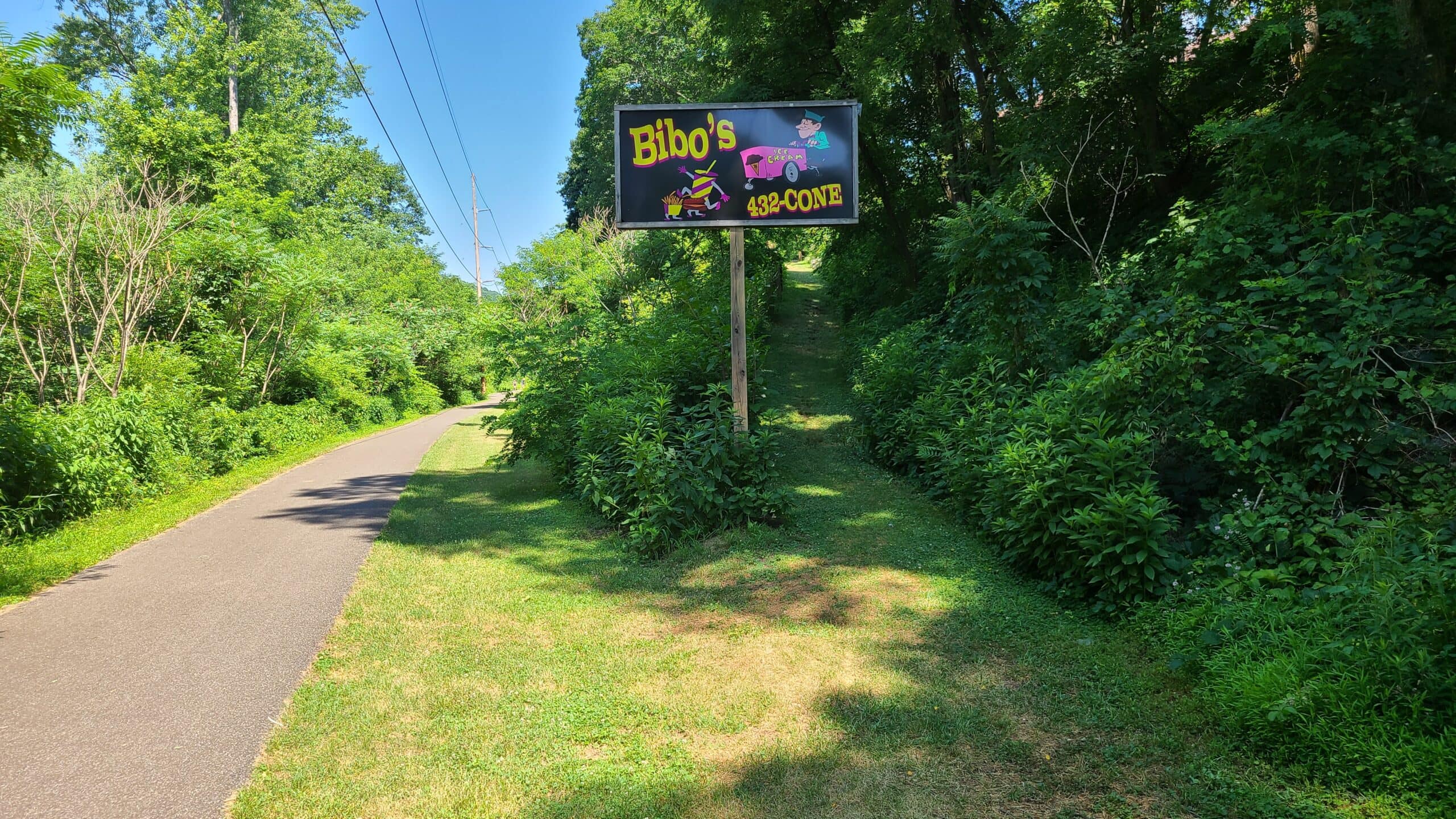
A handful of food stands dot the trail. Most were closed on my trip, what with it being a holiday and all.
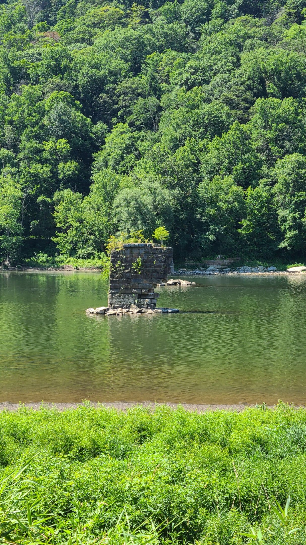
When it comes to exploring industrial heritage, nothing can beat the Ghost Town Trail. But the Allegheny River Trail does an excellent job of highlighting the historic sites and echos of industry you’ll see along the way.
Take this bridge pier, for example. At first glance, saying “it’s in pretty poor condition” is being generous. It looks like it’s one heavy rain or wind gust away from falling over.
But you’re looking at a pier from the Big Rock Bridge, which dates all the way back to 1876 — barely a decade after the end of the Civil War.
The Big Rock Bridge was a double decker bridge with a trolly line on top and pedestrian / animal / vehicle traffic on bottom. It was in heavy use until it was destroyed by ice floes in 1926. I dug through the earliest aerial photos I could find (June 1936) but what you see from the trail is all that remains of what must have been an iconic part of local life.
This is the kind of history that makes rail trails, and especially those in industrial regions like Western PA, so special. I’m always happy to see trail organizers taking the time to point these out.
A few miles south, the Allegheny River Trail crosses under the Sandy Creek Trail. It’s absolutely impossible to miss this bridge:
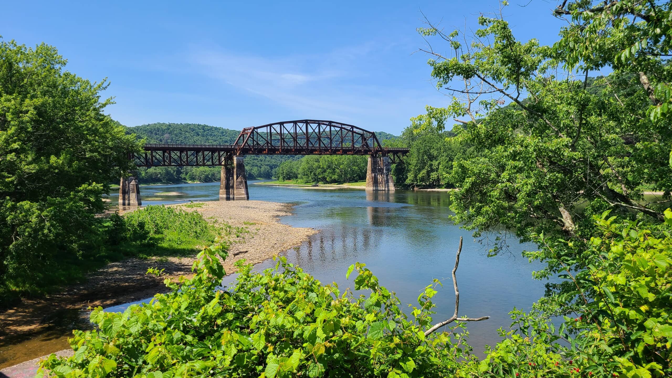
This bridge marks the point where the Allegheny River Trail crosses under the Sandy Creek Trail. I highly recommend checking that one out as well. Both trails have their strengths, and neither is a bad way to spend the afternoon.

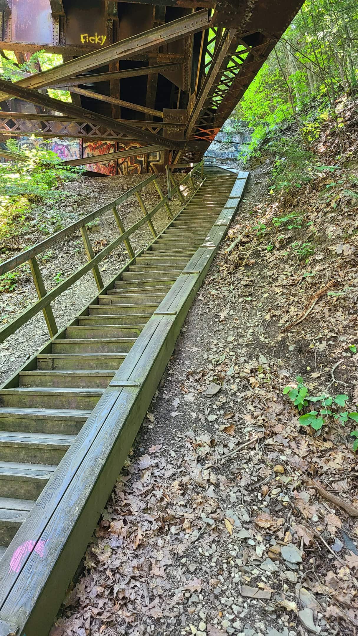
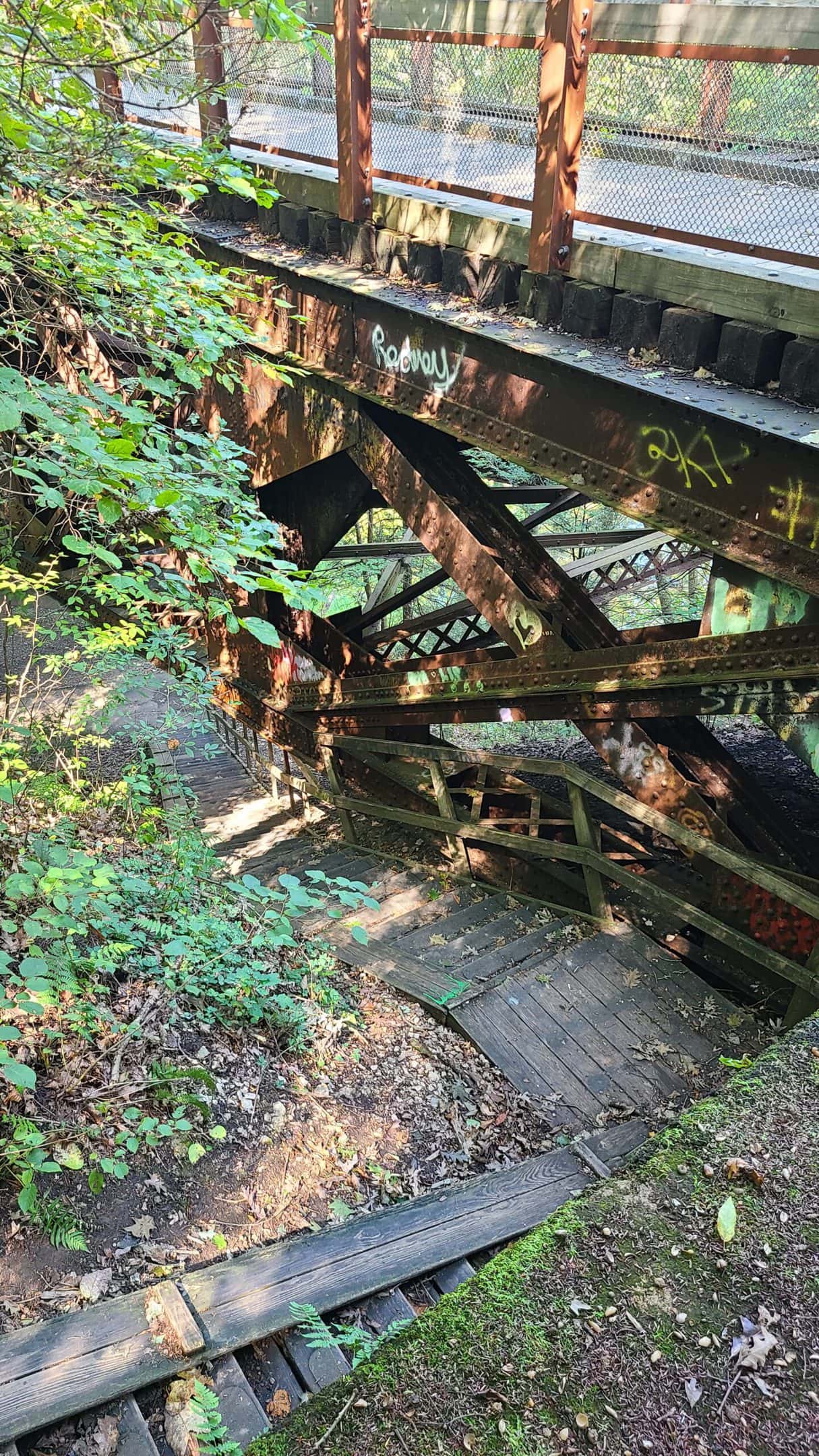
The Allegheny River Trail Association actually created an interchange between the two trails. It’s clearly marked with signage and barely a tenth of a mile long. You’ll need to traverse a steep set of stairs to switch trails, but if your time and endurance permit, I highly recommend trying both.

The trail gives you sweeping views of the Allegheny River as it negotiates its twisty passage through the mountains. Private homes line the trail to the left here, and the wide green space to the right is private property. This is one of the few stretches where you may have to share the trail with vehicle traffic. But since access is limited to residents, this is a far cry from riding along a normal roadway.

I almost ran into this tunnel without realizing what I was doing. See, the trail immediately north of here is wide open and sunny. With my sunglasses on and my focus on gaining ground, I saw a dark patch ahead of me but didn’t immediately realize it was a tunnel. Given the growth surrounding it, I just assumed I was heading into another welcome patch of shade. It wasn’t until I got closer and felt the cool 55-degree air rushing out that I realized where I was.


I spent a ridiculous amount of time here geeking out at this tunnel. It’s just over 3300 feet long (slightly more than half a mile) and cost around $1.5 million in 1867. The stonework is impressive by itself, and then you realize that it was built in 1867 without any modern conveniences like CAD or heavy equipment. The AVTA opened the tunnel to trail users in 2003 and today it’s a refresh blast of cool air on a hot summer day.


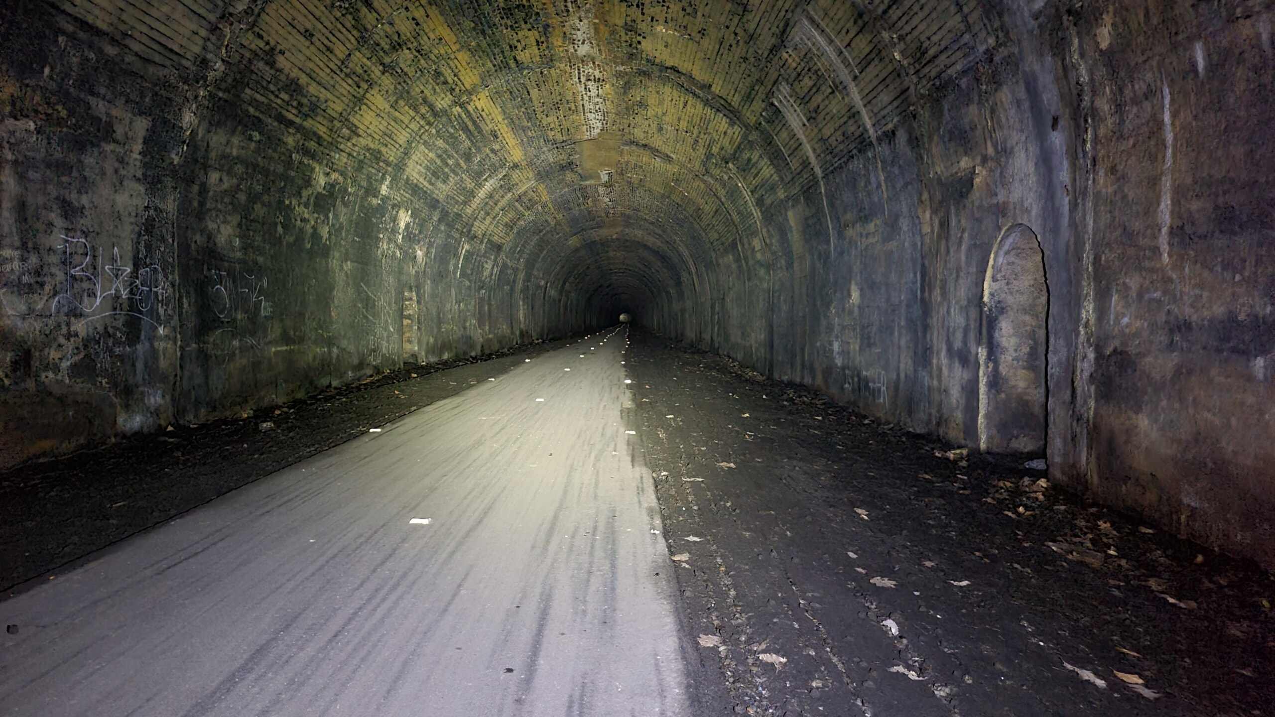
The tunnel is pitch black inside. Make sure you have a good headlight coming through here. As a side note, this is where you’ll really see the difference between a cheap Amazon headlight and a decent brand from your local bike shop. My Bontrager Ion 450 was just enough light to get the job done.
About six miles south sits another tunnel:

The Rockland tunnel is the shorter of the two, clocking in at about 2800 feet, or slightly more than half a mile. It was completed in 1916 to bypass a 4-mile stretch of track that was prone to landslides and icefalls. The builders worked 12 hours a day at 17 cents an hour (roughly $4.60 / hour in 2022 spending power). They likely lived onsite or nearby in company-provided housing.

As the trail continues south, you’ll ride through mostly well-shaded areas. The stretch south of the Rockland tunnel seemed to be the worst for tree roots and organic speed bumps. As you approach Emlenton, you’ll see white fencing start to flank the trail, along with an ominous warning:

The segment near the Emlenton trailhead is the site of a former oil refinery dating back to 1890. Locals created the refinery to push back against the near-monopoly of Standard Oil. Around 1914 this became the Quaker State Refining Corporation. Aerial photos from the 1960s show a vast complex of dozens of structures spanning the length of the river, from the town cemetery to the current trailhead parking lot. Overgrown ruins are clearly visible from the trail itself.
The refinery lasted until the early 1980s, when rail service to the area was discontinued. It remained in partial operation producing waxes until 2000.
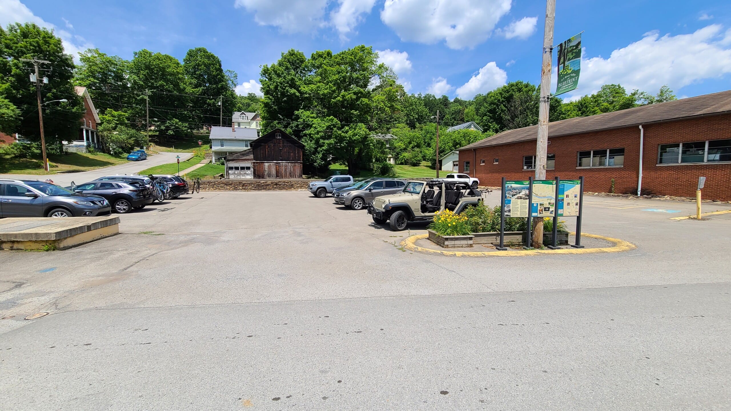
Sadly, those industrial ruins and white fence mean you’ve reached the end of the ride. The Emlenton trailhead has ample parking spread across two lots: one directly on the trail, and this one just past the end. Both are impossible to miss.
The Allegheny River Trail highlights Western Pennsylvania’s hard push to take advantage of their rich history. While it may not have the bridge count of the Sandy Creek Trail or the abundant ruins of the Ghost Town Trail, the paved surface, relatively flat terrain, and river views make it an excellent trail for a relaxing weekend ride or pushing your endurance. I’m looking forward to doubling back for my first metric century this fall!