Earlier this year I did my first segment on the Great Allegheny Passage from Meyersdale PA to Cumberland MD. Work and weather have not cooperated with letting me ride much over the summer, so as fall approaches I wanted to explore as much of the trail as possible. That means taking advantage of any weather that isn’t tornadoes, thunderstorms, or active swarms of lava bees. Let’s go!

For a quick background refresher, the GAP is a 150-mile trail that follows the paths of four abandoned rail lines from Pittsburgh PA to Cumberland MD. The trail seamlessly meshes with the C&O Canal Trail, providing a continuous 335-mile ride from Pittsburgh to Washington DC. I’m splitting the trail up into 30-ish mile segments because that’s about the point where my brain stops working.
I’ve already written about the Meyersdale trailhead, and it’s arguably the nicest I’ve found so far on the GAP. There’s a museum complete with a working replica of an actual Western Maryland locomotive (shown above)! So this past weekend, I decided my journey would begin here. Except that this time, I would head west towards Pittsburgh.

Minutes after starting my ride I arrived at the Salisbury Viaduct. The viaduct was built in 1911 for the Western Maryland Railroad’s Connellsville extension and opened to train traffic in 1912. After being abandoned with the rest of their line in 1975, the viaduct sat largely neglected. In 1998, after spending about $1.3 million on renovations, it was converted for trail use and opened again as part of the GAP. Today it provides a great photo op across the valley.
After crossing the viaduct, the trail more or less follows the Casselman river as it winds through farmlands and forests. At one point my ride was briefly interrupted by an uppity pheasant, who had no problem blocking the trail but refused to stand still long enough for me to get a photo.
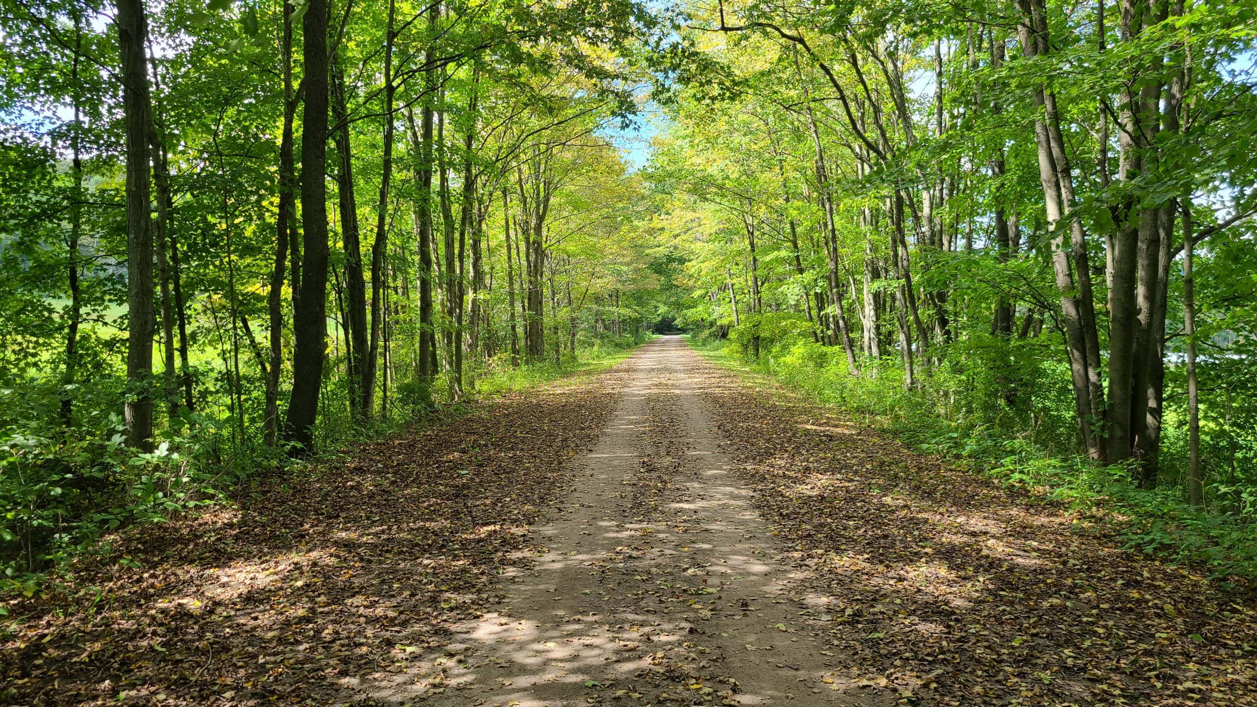
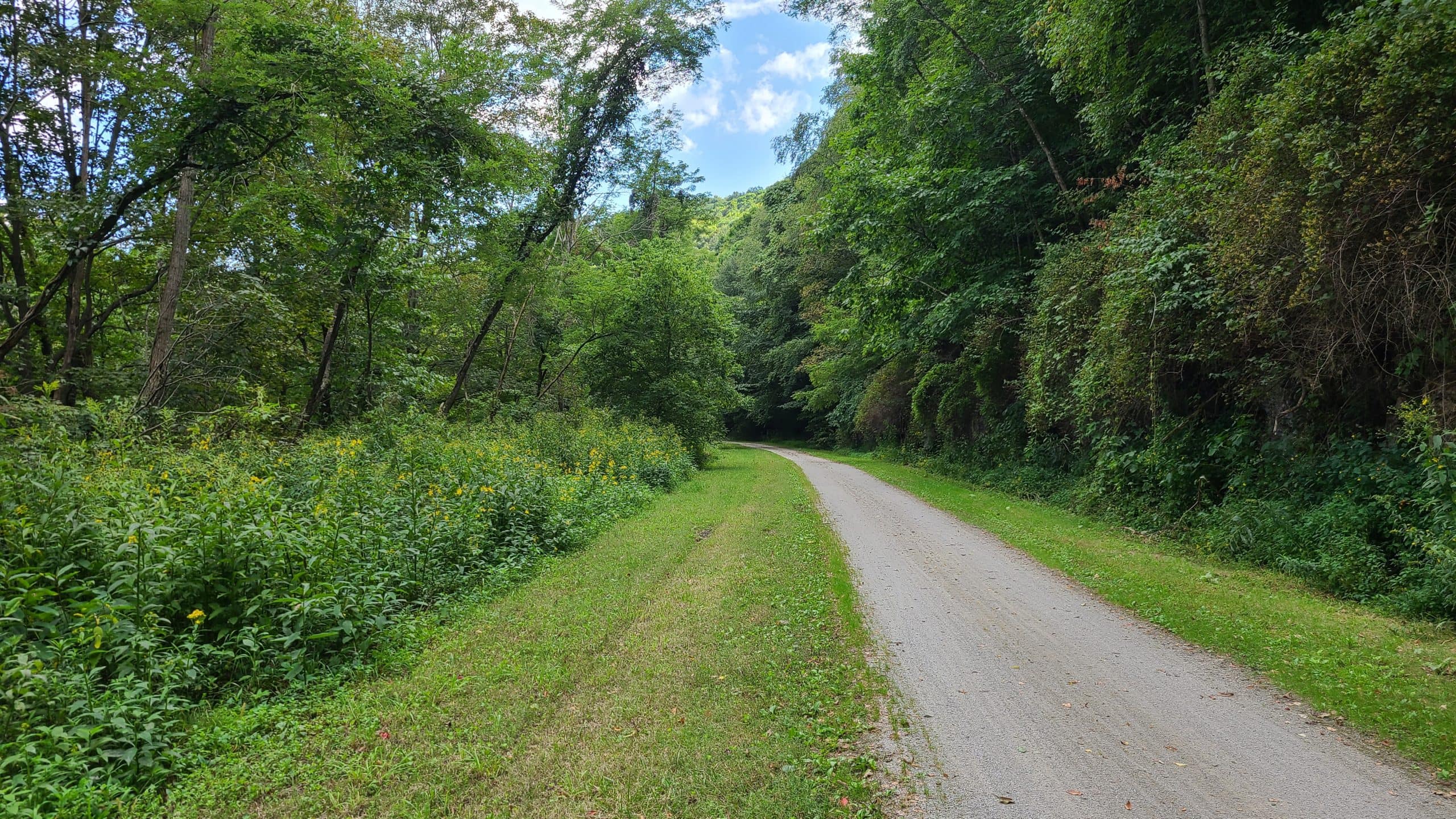
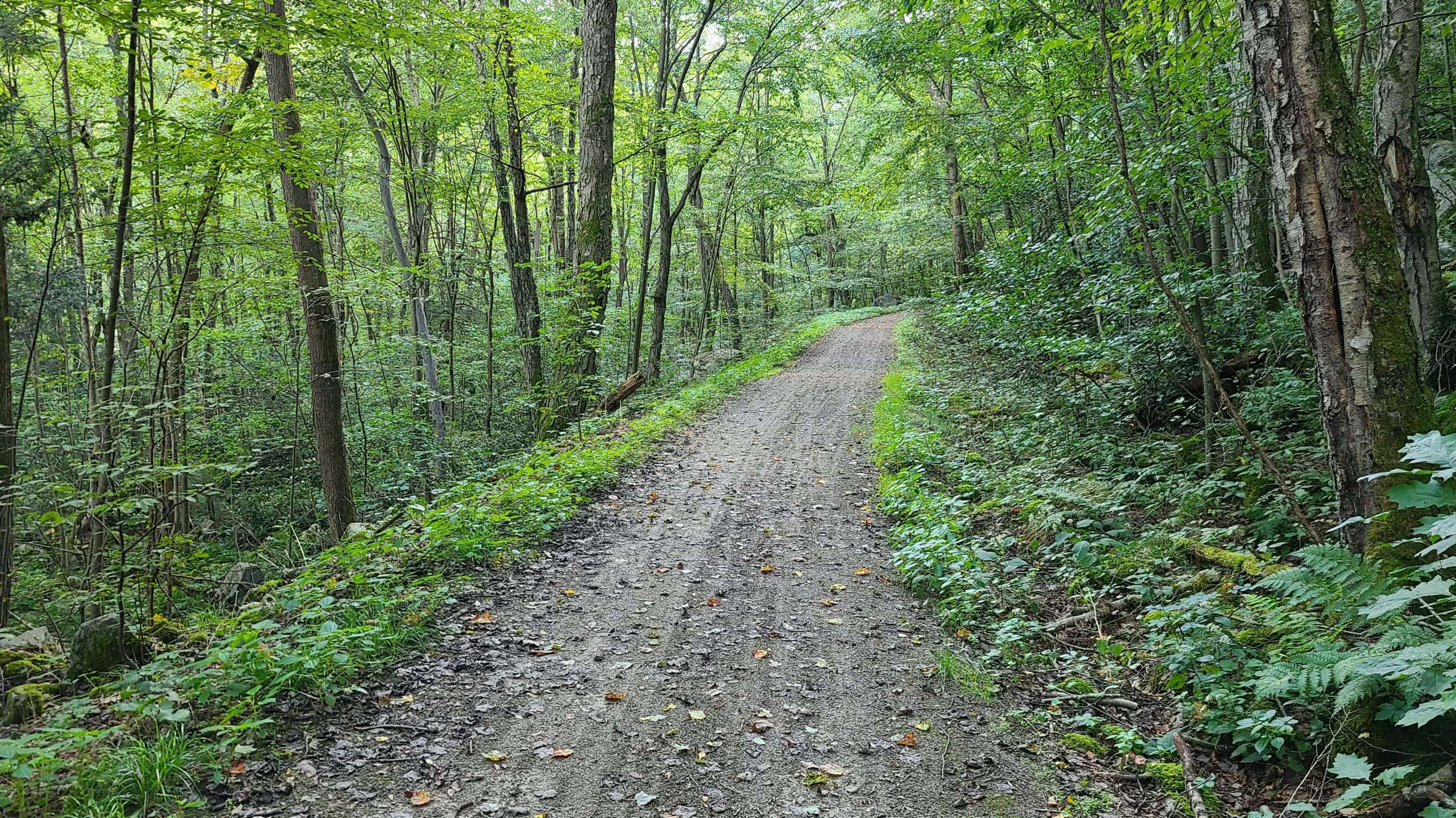
Most the trail looks impossibly stunning in late summer. Tree-lined passages like this are common. I can’t imagine how spectacular it will look in the fall.
For the most part, the trail surface is either packed dirt or fine gravel. The trail immediately surrounding a few of the trailheads is paved, but this is a rarity. One of the “worst” sections is the bypass at the Pinkerton Tunnel — more on that below — but even that was slightly rougher packed dirt. The entire trail, so far, has been suitable for any type of bike.
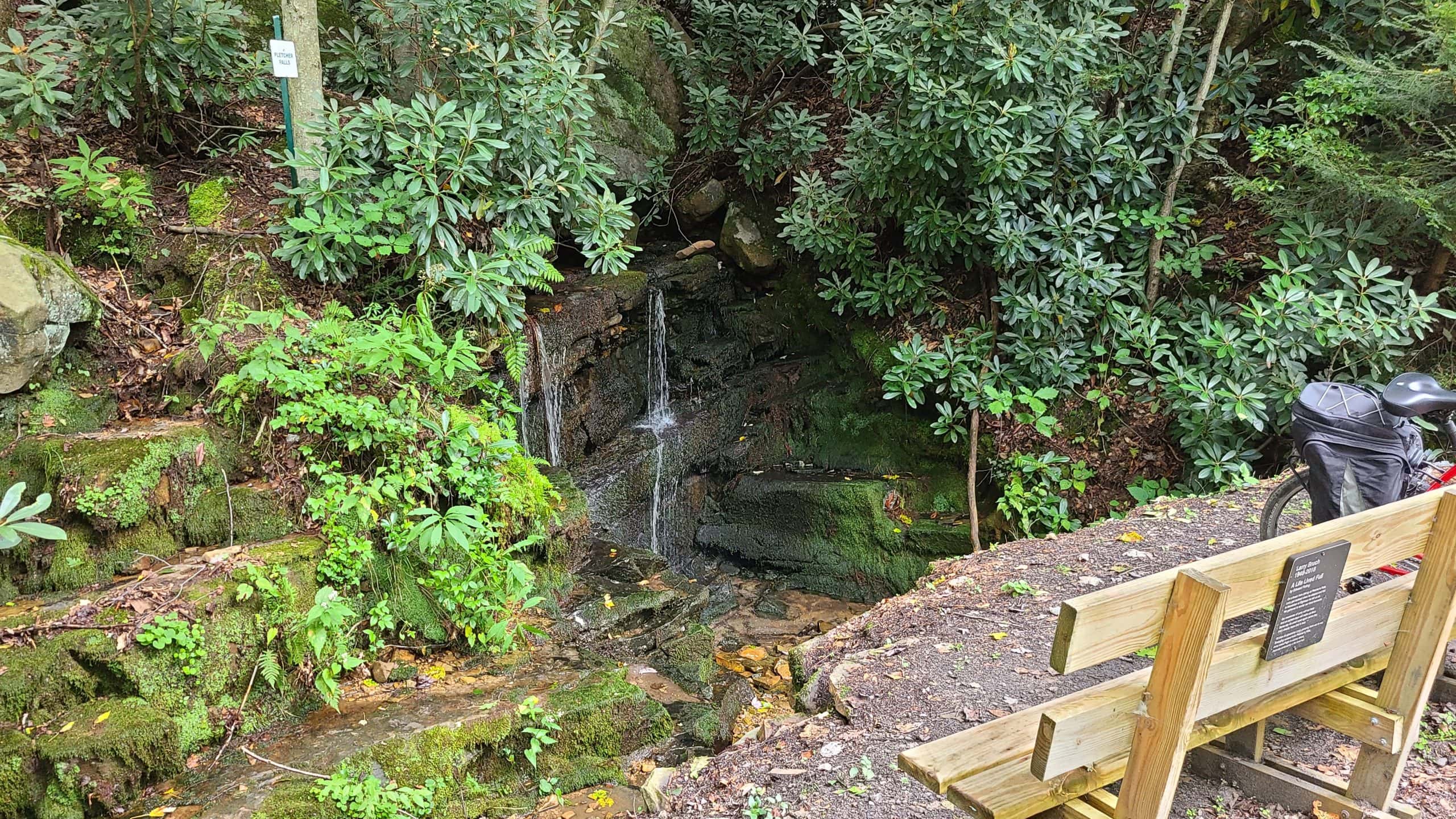
Pletcher falls provided a cool nook to pause in. This also marks the approximate location where my cell service died. It’s a bit jarring — though understandable, given that you’re riding through a deep valley in the middle of nowhere — to have no cellular service for 20+ miles.
Let’s talk about that for a second.
This was the first year I’ve put any effort whatsoever into serious rail trail riding. And so far, all of the rides I’ve taken — Northwest Lancaster County, York Heritage, Buffalo Valley, Ghost Town Trail, even other parts of the GAP — have been exciting. They’ve all offered industrial ruins, 19th-century tunnels, abandoned towns, rolling farmland, quaint villages, brewpubs, bike shops, and other landmarks to keep you busy.
This segment of the GAP primarily featured isolation. Garrett to Rockview is slightly more than seven miles of this:
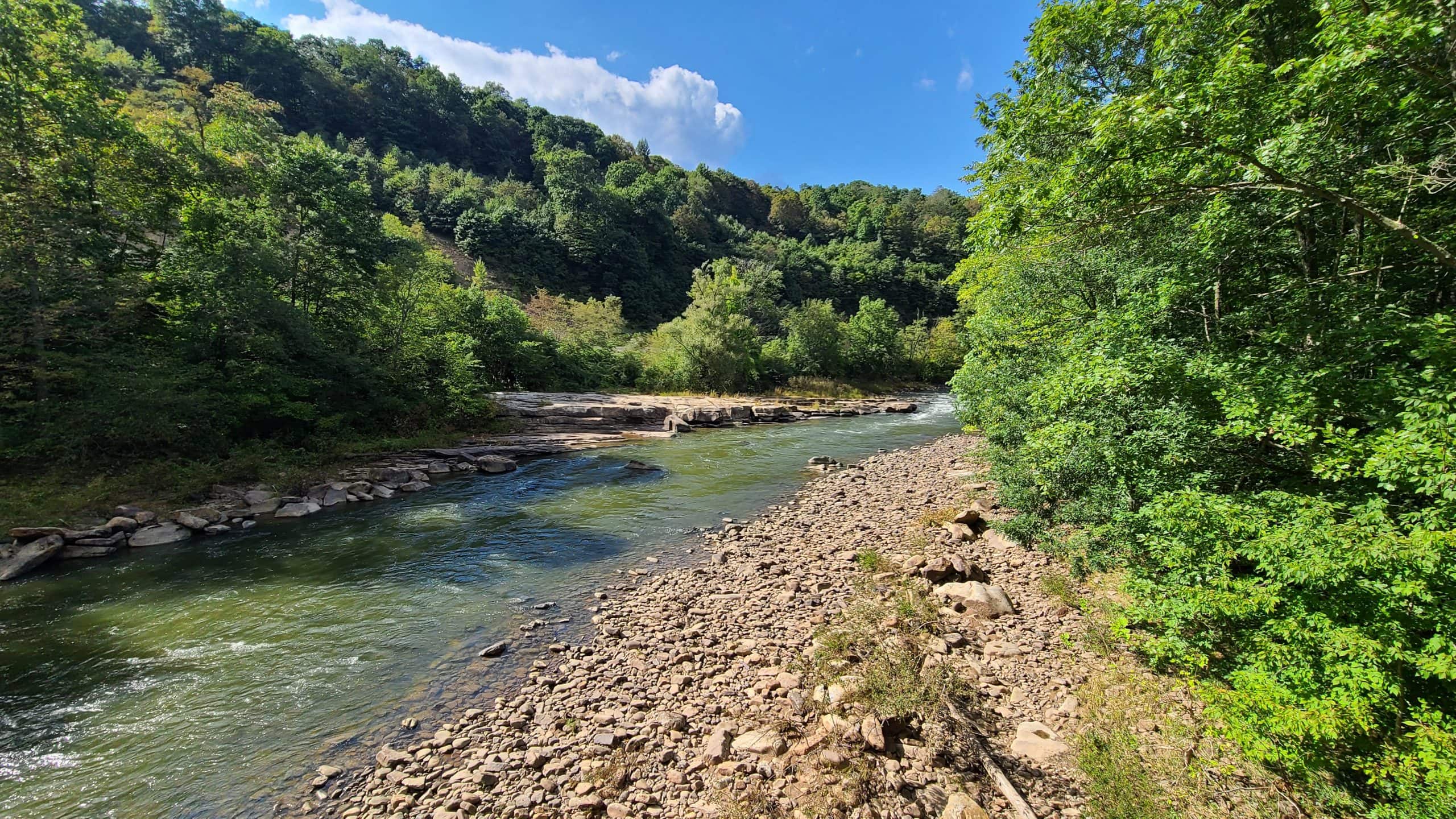
Once you pass Rockview, you’re entirely on your own for the 17 miles to Confluence. Don’t get me wrong: that isolation isn’t a bad thing. This was a great opportunity to take in the scenery, fully focus on the ride, and pick up the speed (up to the maximum 15 MPH, of course). Riding in the downhill direction on a mid-70s afternoon with scattered clouds, this segment redefined the word “relaxing”.
I encountered other riders heading in the opposite direction every ten minutes or so. And it stands to reason that there was probably someone about ten-ish minutes behind me, and maybe another ten-ish ahead. Aside from the trailheads and the nonexistent cell service, they’re your only backup plan in case of emergency.
Long story short, bring extra water, a basic first aid kit, and an extra snack bar or two. And don’t be like me: bring a patch kit and learn how to use it before you set out.
I was about eight miles west of Rockview when I saw the highlight of today’s trip: the Pinkerton tunnel!

The Pinkerton tunnel and the land surrounding it has quite a history behind it. There are lots of places to read more about it, but the summary reads like this:
The upper Pinkerton tunnel was built by the B&O Railroad in 1871. That timber-lined tunnel caught fire and was closed in 1879. A 1.5-mile bypass was built along the horn and remained in use until the tunnel was rebuilt. In 1911, the Western Maryland railroad built the Pinkerton tunnel you see above. After Western Maryland abandoned the line in 1975, the tunnel deteriorated and suffered several major collapses. After a lot of blood, sweat, and tears (and money), the tunnel was finally reopened as part of the GAP trail in 2015.

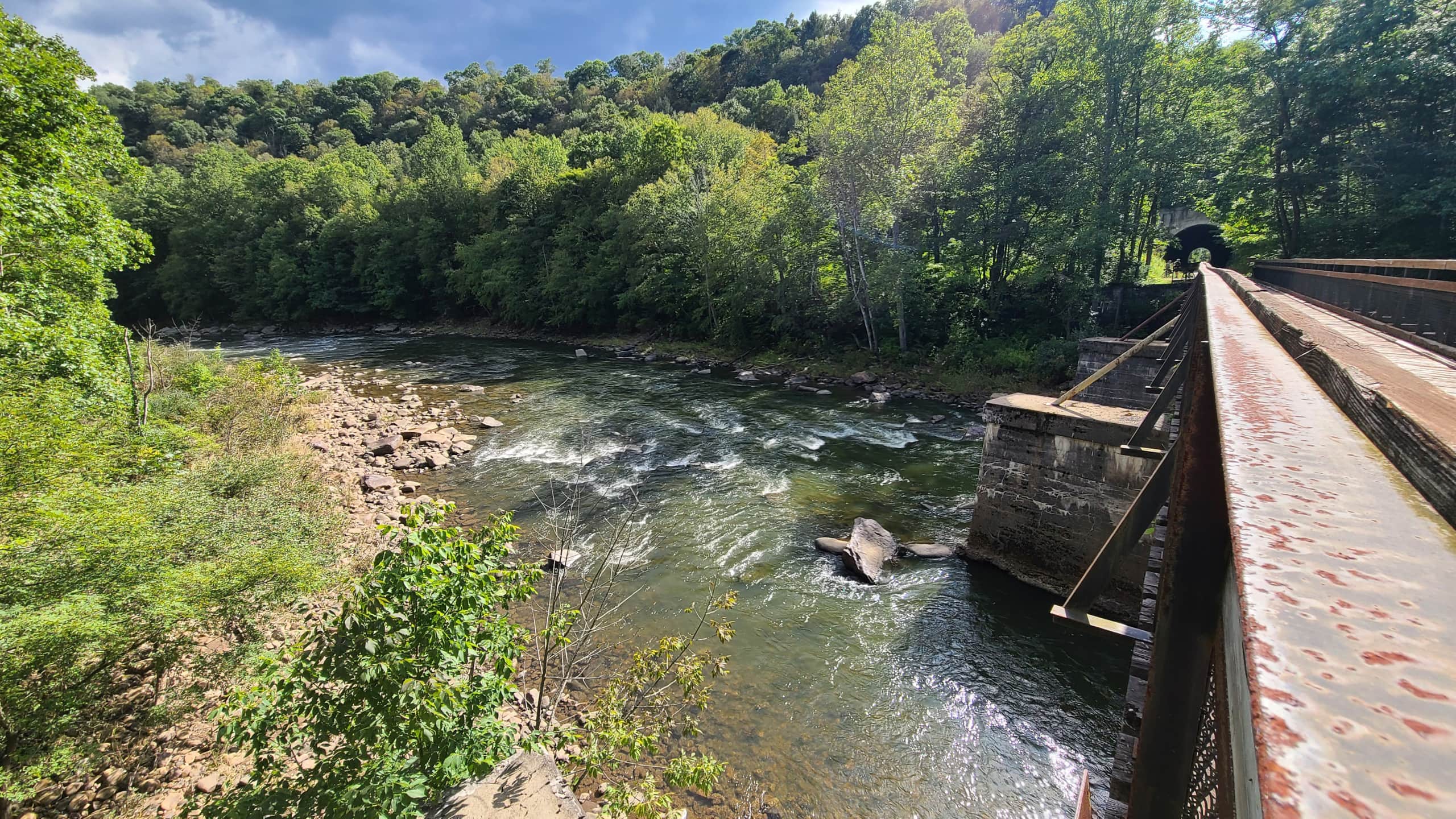
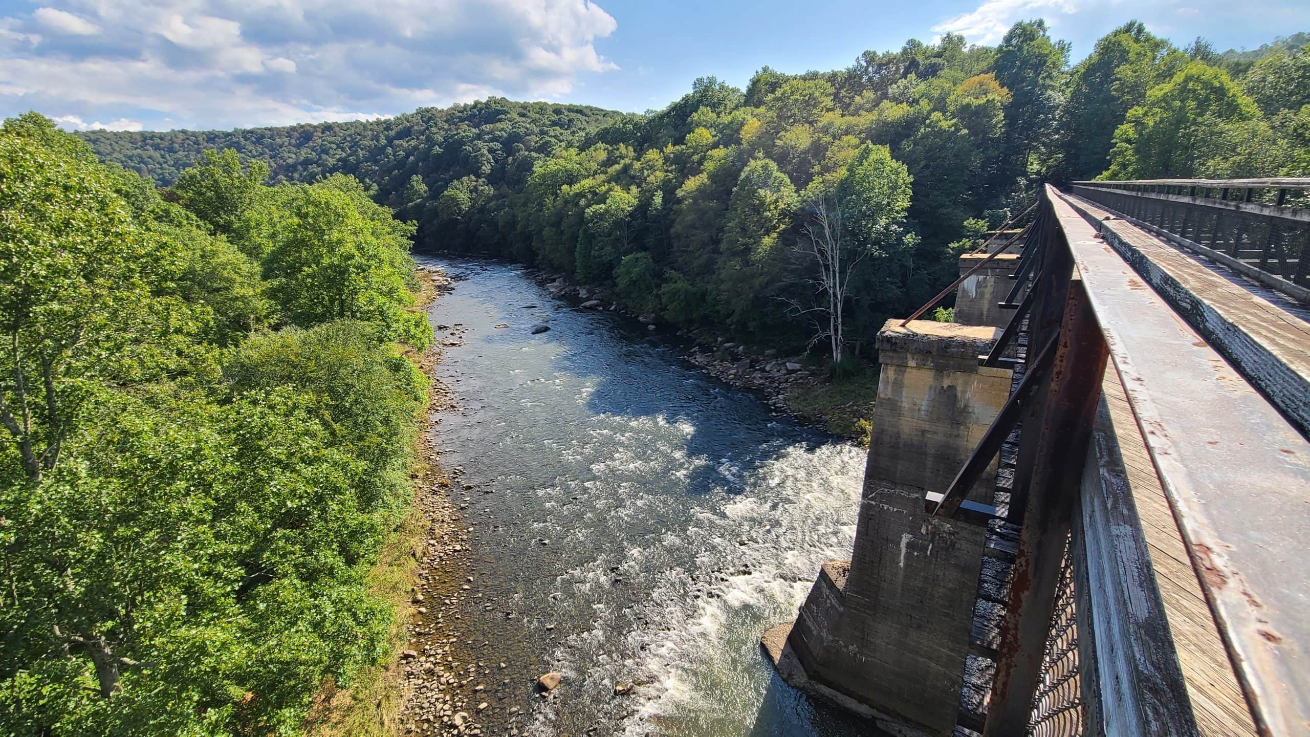
The tunnel is very short and has a bridge on either side. The eastern bridge is the Pinkerton low bridge (pictured above), while the western bridge is the Pinkerton high bridge (below). They’re named because although they’re roughly level with each other, the river drops substantially as it races around the horn. Thus, the Pinkerton high bridge is about 100 feet above the river, while the low bridge is only about 30 feet above.
But the Pinkerton story doesn’t end there. The B&O tracks above are now owned by CSX, who literally dug out the older Pinkerton tunnel about ten years ago. If you want the factual explanation, you can read about the National Gateway Project and how it impacted the tunnel. But I promise my wife’s explanation is much more interesting:
“Back around 2010 a bunch of hipsters decided they needed restore the tunnel to its ‘original’ 1870s condition. They accidentally took a little too much off the mountain, so they dug out a little on the other side to even it up. But then they realized they took too much off, so they had to go back to the first side to take more out. This continued and the next thing you know, half the mountain was gone. So they finally just gave up and dug out the old tunnel so they could pretend it never existed in the first place.“
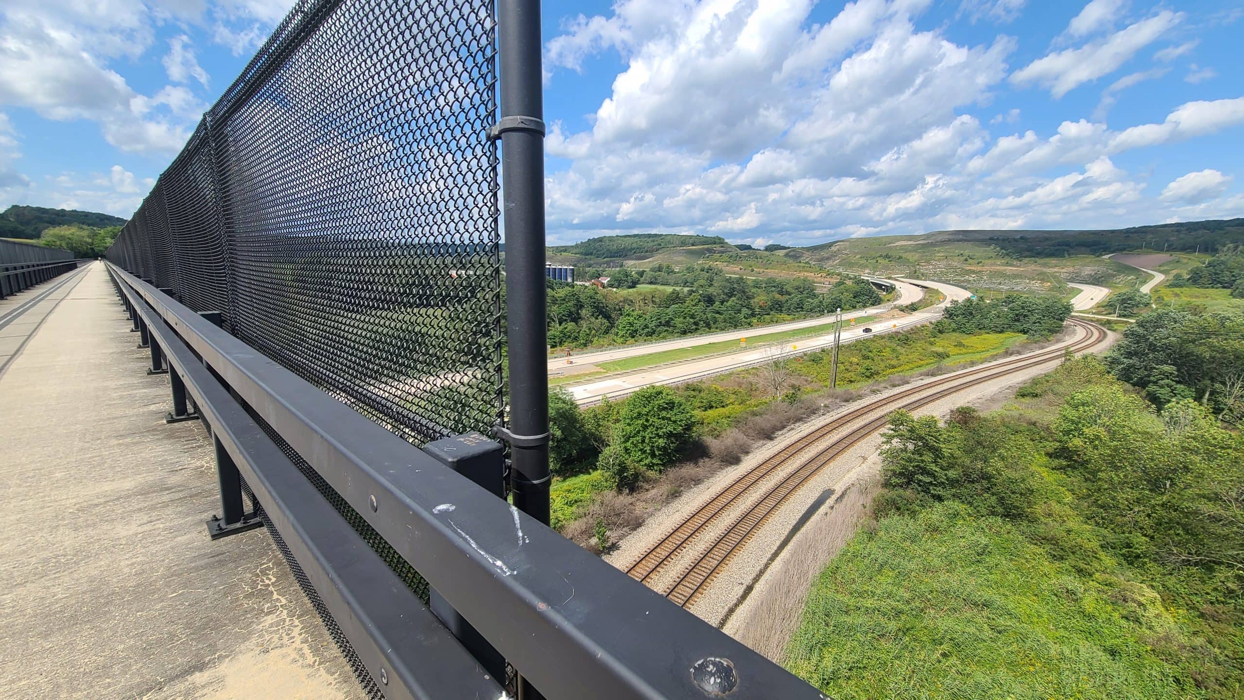
You can see the deep cut in the upper-left corner of the photo below. That line is still in use for freight as well as Amtrak’s Capitol Limited service.

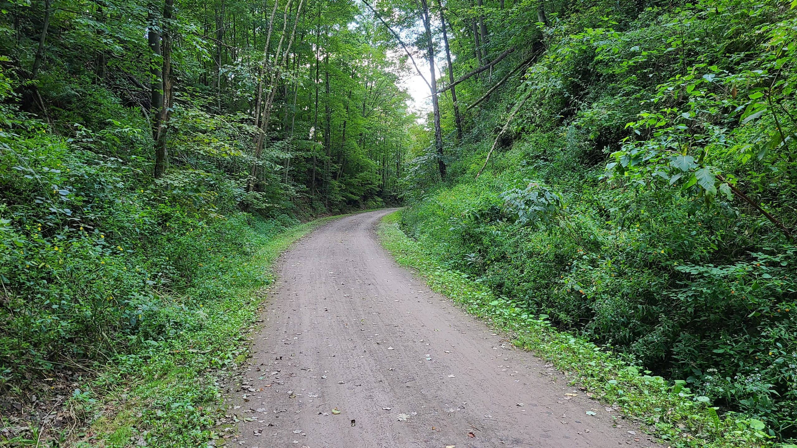
The tunnel itself is pretty short, and the interior is no longer original. So I decided to ride the old bypass route around the southern tip of the horn.
This part of the trail was a little narrower and slightly less well-kept than the rest. It’s still easily accessible on a road bike but you’re definitely a little closer to nature. The spoil from excavation of the upper tunnel was placed on top here, and if you look up (especially on the western side) you can see evidence that the terrain has been modified.
I noticed a lot of branch trails and thought about seeing if there were any remnants of the original CSX / B&O bypass loop (which would’ve been at a different elevation than the existing bypass) from the 1880s, but clouds were moving in. I decided it was time to press on.

Remember how I mentioned how isolated this segment of the trail can be? That results in some truly amazing scenery.

This telegraph pole was just off the trail. Note the still-in-tact wiring. Western Maryland abandoned this line in the 1970s, so odds are good that’s over half a century old. And as I just typed that, I realized that having been born in the 1970s, I too am almost half a century old.

As the miles ticked by, I knew I had to be approaching my endpoint in Confluence. My wife was going to meet me in town for the ride home, but I hadn’t had any cell service for nearly two hours. Fortunately our meeting place proved to be very easy to find.

The Lucky Dog Cafe is a low-key cafe right off the trail with outdoor seating, a decent beer selection, and — hallelujah — wifi! Although I couldn’t snag my traditional post-ride steak, we ordered crispy fried Bbrussels sprouts drizzled with sriracha and a “small” plate of loaded nachos that redefined the limits of “small” (it was huge). Service was quick, outdoor seating was ample, and the prices were fair. Be sure to make a stop if you’re heading through!
We still didn’t have cell service, but this is exactly why I ordered my car with factory GPS. Unlike Apple Maps and it’s hand-crafted artisanal route through 143 different counties, Subaru’s built-in navigation gave us a fast and direct route back to the turnpike and had us home in no time.
I don’t know if I’ll be able to do any serious cold weather riding, so my plans to segment the entire GAP may have to be shelved until next year. There are still a few trails in northern PA that I want to catch during the fall months, and I’ve barely scratched the Maryland / Virginia / DC side of the GAP.